We have a DW1000 based system performing two way ranges. In one specific region the system generates sorter than truth ranges to one specific anchor.
In other locations, both closer to and further from the anchor the range is good.
While in the bad region the ranges to other anchors are still mostly good, one other anchor in roughly the same direction as the bad one shows a slight wobble in the range, the rest are solid.
I’ve seen similar issues in the past but when that happened it impacted multiple anchors and in multiple locations. In that situation the CIR data has shown all sorts of noise. This time the CIR data looks very good with no obvious issues.
The chart below shows the measured tag to anchor range over time while passing through the bad region.
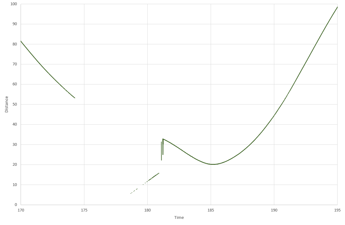
Given how location specific the issue is there must be some environmental reason for this but I have no idea what. It doesn’t help that due to travel restrictions I’m having to try and fault find this remotely but lots of photos and video calls haven’t shown up any obvious causes. The building construction is very regular and this region doesn’t show any obvious differences to the areas either side of it.
I’m running out of ideas as to what could be causing this so any ideas on where to look would be appreciated.